Indicator Engineering on a Cloud-Edge GIS Platform Assisting Post-Seismic Reconstruction and Rehabilitation
Objective
The objective of this project is to create a GIS-based platform that supports post-seismic reconstruction by integrating cloud-edge computing, data management, and indicator engineering. The platform will monitor reconstruction activities in real-time, track project progress, and facilitate communication between all stakeholders involved in the recovery process.
Abstract
This project develops a comprehensive GIS platform integrating cloud-edge computing to support post-seismic reconstruction. The system focuses on monitoring the reconstruction process across 56 municipalities affected by the 2009 earthquake in Italy, ensuring real-time data accessibility, project tracking, and decision-making efficiency. The platform utilizes hybrid cloud-edge architecture to optimize data processing, enhance scalability, and improve transparency. Users can manage georeferenced data, track construction progress, and interact with multiple stakeholders using GIS, edge computing, and indicator engineering. The platform aims to assist post-seismic recovery efforts and can be adapted for similar applications in other regions or for future reconstruction projects.
Keywords: GIS, Cloud Computing, Edge Computing, Post-Seismic Reconstruction, Hybrid Architecture, Indicator Engineering, Real-Time Data, Decision Support.NOTE: Without the concern of our team, please don't submit to the college. This Abstract varies based on student requirements.
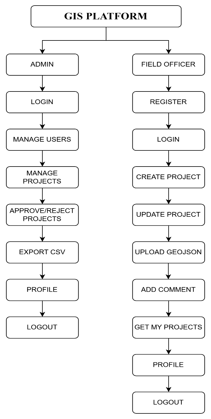
Block Diagram
Specifications
HARDWARE REQUIREMENTS:
· Processor: Intel i3 or higher
· RAM: 4GB minimum
· Hard Disk: 160GB minimum
SOFTWARE SYSTEM CONFIGURATION:
· Operating System: Windows 7/8/10
· Frontend: ReactJS
· Backend: Spring Boot with java
· Database: MySQL
· IDE: IntelliJ IDEA & VS Code


 Paper Publishing

Request Call Back
Would you like to receive a free callback now?
Choose the best time for callback:
Leave your message and we will contact you as soon as possible

6-2-85/B, Old Maternity Hospital Road, Thyagaraja Nagar, Tirupati, Andhra Pradesh – 517501
+91 9030333433
+91 9393939065
0877-2261612

Disclaimer - Takeoff Edu Group Projects are not associated or affiliated with IEEE in any way. The IEEE Projects mentioned here are mentioned in the context of student projects, whose ideas are derived from IEEE publications, not projects of or by IEEE.