Aerial Image Classification in Post Flood Scenarios Using Robust Deep Learning and Explainable Artificial Intelligence
Objective
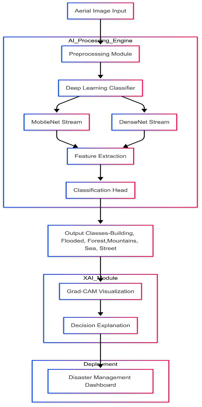
The certain objectives this study intends to achieve by developing a robust deep learning system in post-flood aerial image classification using MobileNet and DenseNet architectures are Classes: building, flooded, forest, mountains, sea, and street in aerial images. The study also aspires for the integrated use of Explainable Artificial Intelligence (XAI) techniques because Grad-CAM provides visual explanations for model output predictions so that model transparency and trust could be achieved. This, with plenty of hope, will come in handy when it comes to effective assessment by disaster management professionals during and after flooding.
Abstract
NOTE: Without the concern of our team, please don't submit to the college. This Abstract varies based on student requirements.
Block Diagram
Specifications
. HARDWARE & SOFTWARE REQUIREMENTS
4.1 SOFTWARE REQUIREMENS
Operating System : Windows 7/8/10
Server side Script : HTML, CSS, Bootstrap & JS
Programming Language : Python
Libraries :Flask, Torch, Tensorflow, Pandas, Mysql.connector
IDE/Workbench : VSCode
Server Deployment : Xampp Server
Database : MySQL
4.2 HARDWARE REQUIREMENTS
Processor - I3/Intel Processor
RAM - 8GB (min)
Hard Disk - 128 GB
Key Board - Standard Windows Keyboard
Mouse - Two or Three Button Mouse
Monitor - Any

Demo Video


Request for Video
 Paper Publishing
Request Call Back
Would you like to receive a free callback now?
Choose the best time for callback:
Leave your message and we will contact you as soon as possible

6-2-85/B, Old Maternity Hospital Road, Thyagaraja Nagar, Tirupati, Andhra Pradesh – 517501
+91 9030333433
+91 9393939065
0877-2261612

Disclaimer - Takeoff Edu Group Projects are not associated or affiliated with IEEE in any way. The IEEE Projects mentioned here are mentioned in the context of student projects, whose ideas are derived from IEEE publications, not projects of or by IEEE.